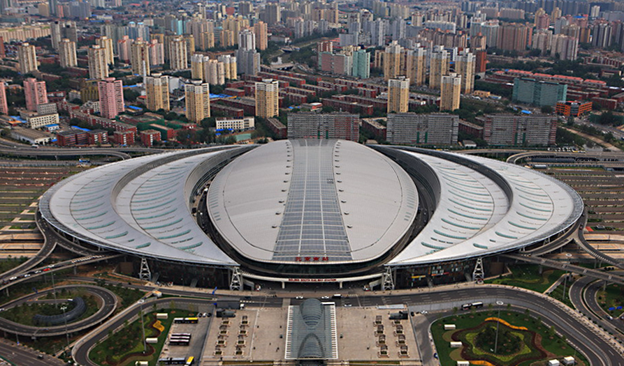
Beijing South Station, one of China’s largest high-speed rail hubs and the pilot site for a national signage system
Background
With China’s high-speed rail network accelerating at an unprecedented pace, Beijing South Station faced the challenge of guiding massive passenger volumes through an extremely complex spatial environment—at a time when no unified signage standards existed for transportation hubs of this scale.
This project was initiated by the Ministry of Railways to support the opening of Beijing South Station as a national high-speed rail gateway.
Outcome & Impact
Adopted as the complete signage system for Beijing South Station
Supported growth from ~20,000 daily passengers (2007) to 185,000+ (2025)
Became the foundation of the national railway passenger information signage standards
Deployed across China’s high-speed rail network

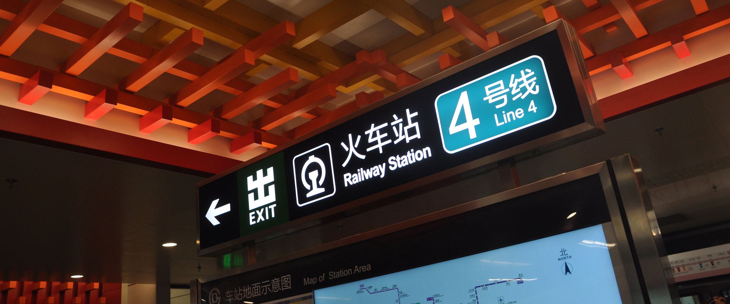
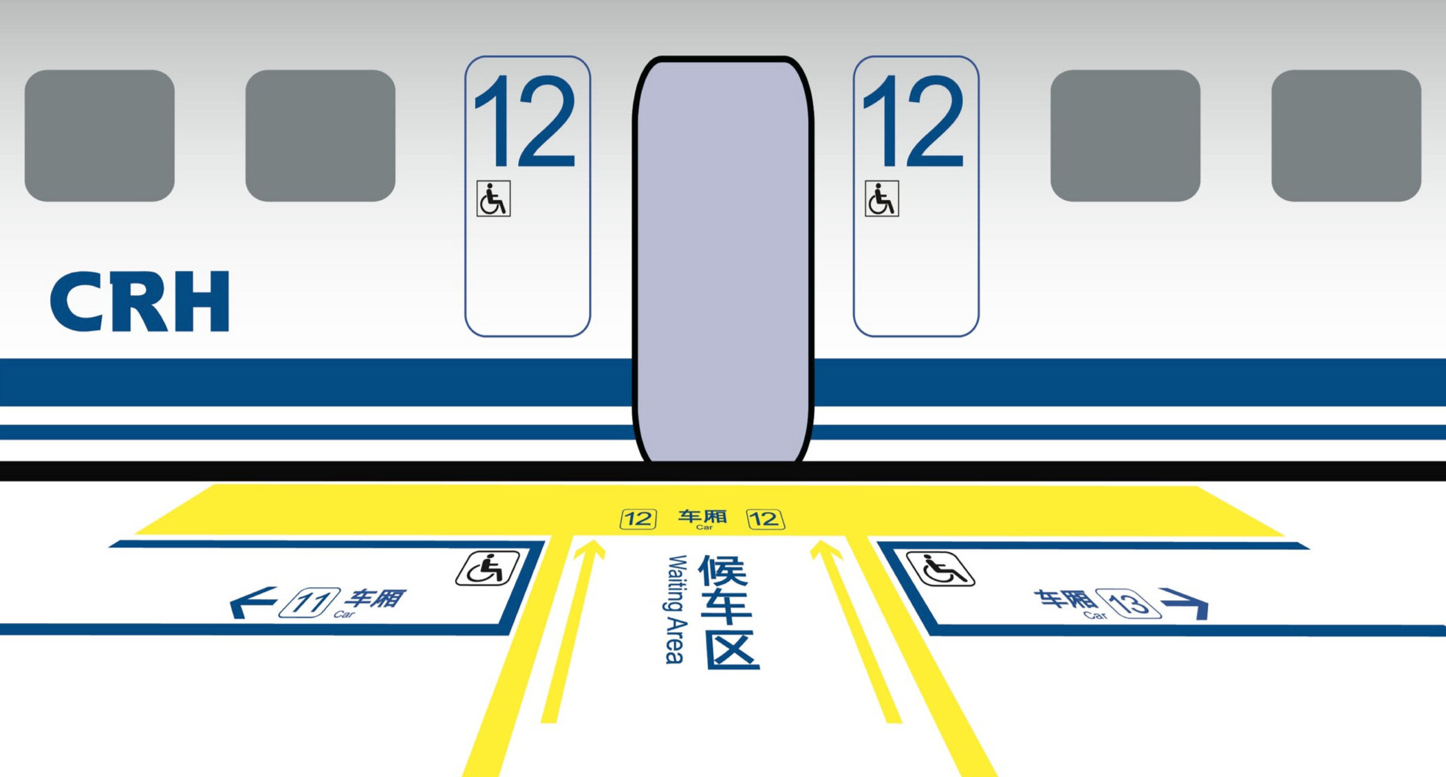
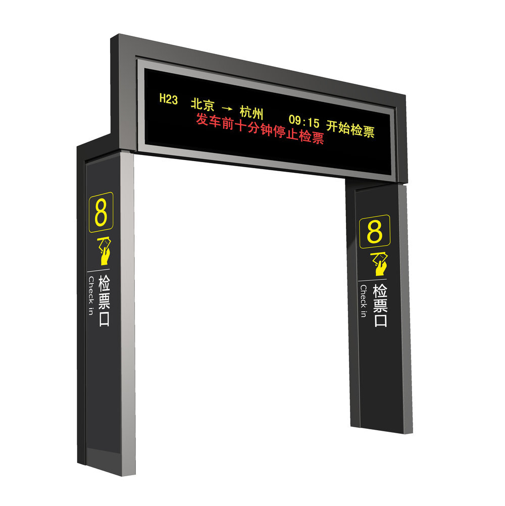
The implemented signage system in active use at Beijing South Station
Role & Leadership
Client: Ministry of Railways of China
Project Duration: 2007–2008
My Role
Information Design Lead
Led a team of 4 information designers
Collaborated with Industrial Design, Graphic Design, and Copywriting teams (45+ designers total)
Led information design end-to-end, integrating research, spatial logic, and system standards
Conducted design research and legibility testing
Delivered the Design Research Report
Co-authored the Railway Passenger Information Signage System Graphic Signs & Elements Application Norm
Design Framework
Rather than separating information, graphic, and industrial design into isolated phases, I led information design as a system that informed every design decision throughout the project.
The work centered on three fundamental questions:
Where — Signage distribution & location
What — Information content and hierarchy
How — Form, legibility, and physical expression
This framework guided the entire project from planning through implementation.
Where - Signage Distribution & Location
Now we go into process, but structured and selective.
Stage 1: Spatial Planning
Using the client’s initial architectural plans, we modeled three primary station levels:
Elevated floor: ticketing, waiting areas
Ground floor: boarding gates, platforms, transfers
Underground floor: parking and access
Key actions:
Identified all usable spatial units
Grouped units into functional zones
Mapped relationships between zones
Outcome: a spatial foundation for consistent information placement.
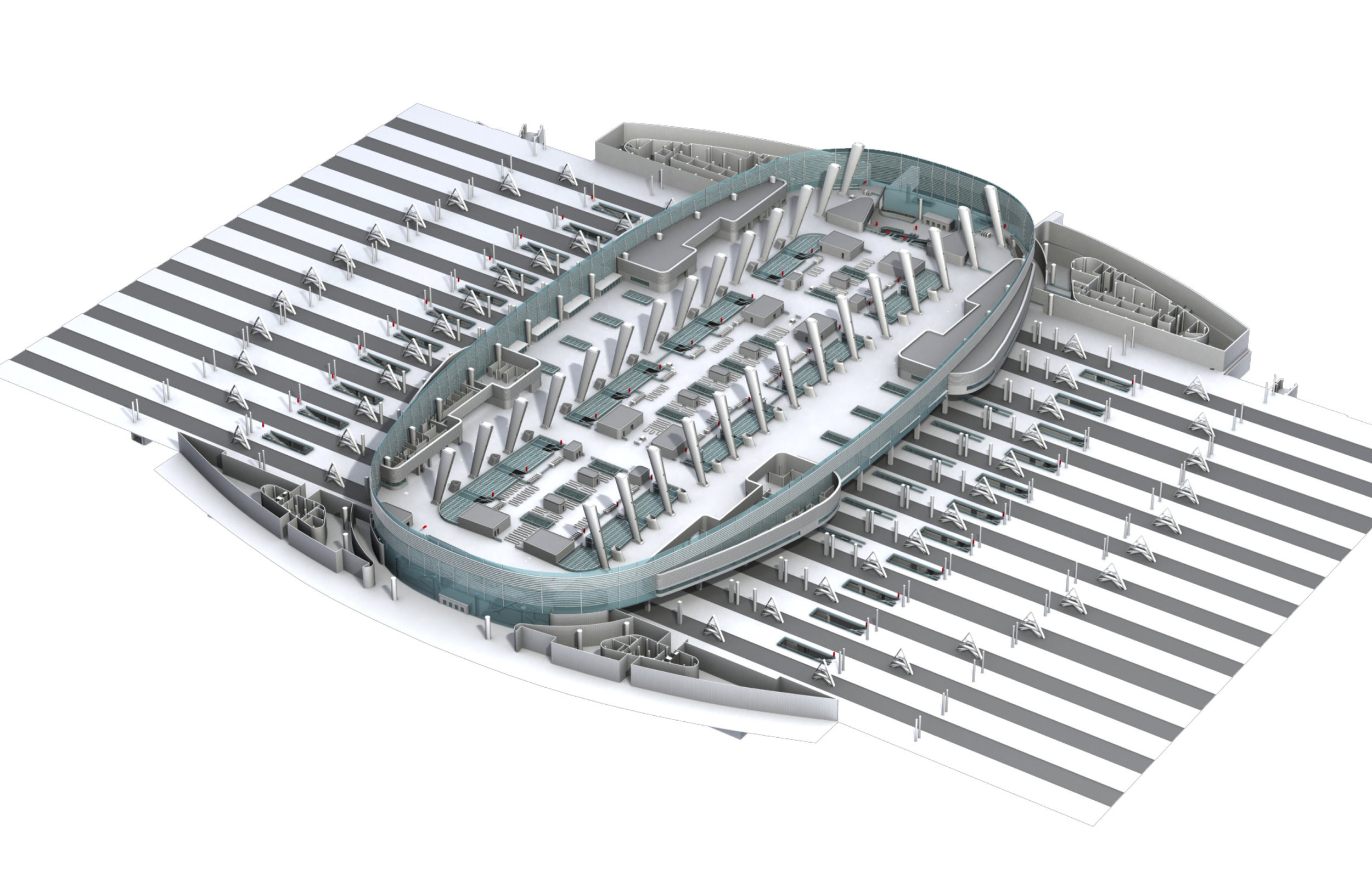
Spatial modeling of station levels to identify functional zones and usable space units
Stage 2: Passenger Circulation Routes
To design effective wayfinding, we first mapped how people actually move.
We identified:
Routes from each entrance to every destination
Routes between destination areas
Circulation paths within individual zones
This revealed:
high-traffic convergence areas
potential congestion points
moments of uncertainty during transfers
Outcome: a comprehensive circulation model across the entire station.

Mapping passenger circulation routes across the station to understand movement patterns and information needs


Stage 3: Decision Points
This stage connected space and information.
Based on circulation analysis, we identified all decision points—locations where passengers must:
choose a direction
confirm a route
or correct a path
At each decision point, we:
defined required information types
determined information priority
specified signage placement and orientation
Decision points became the anchors of the signage system, ensuring that information appeared:
exactly when needed
in the correct sequence
without redundancy
Outcome: a decision-driven signage placement strategy that reduced cognitive load and unnecessary signage.
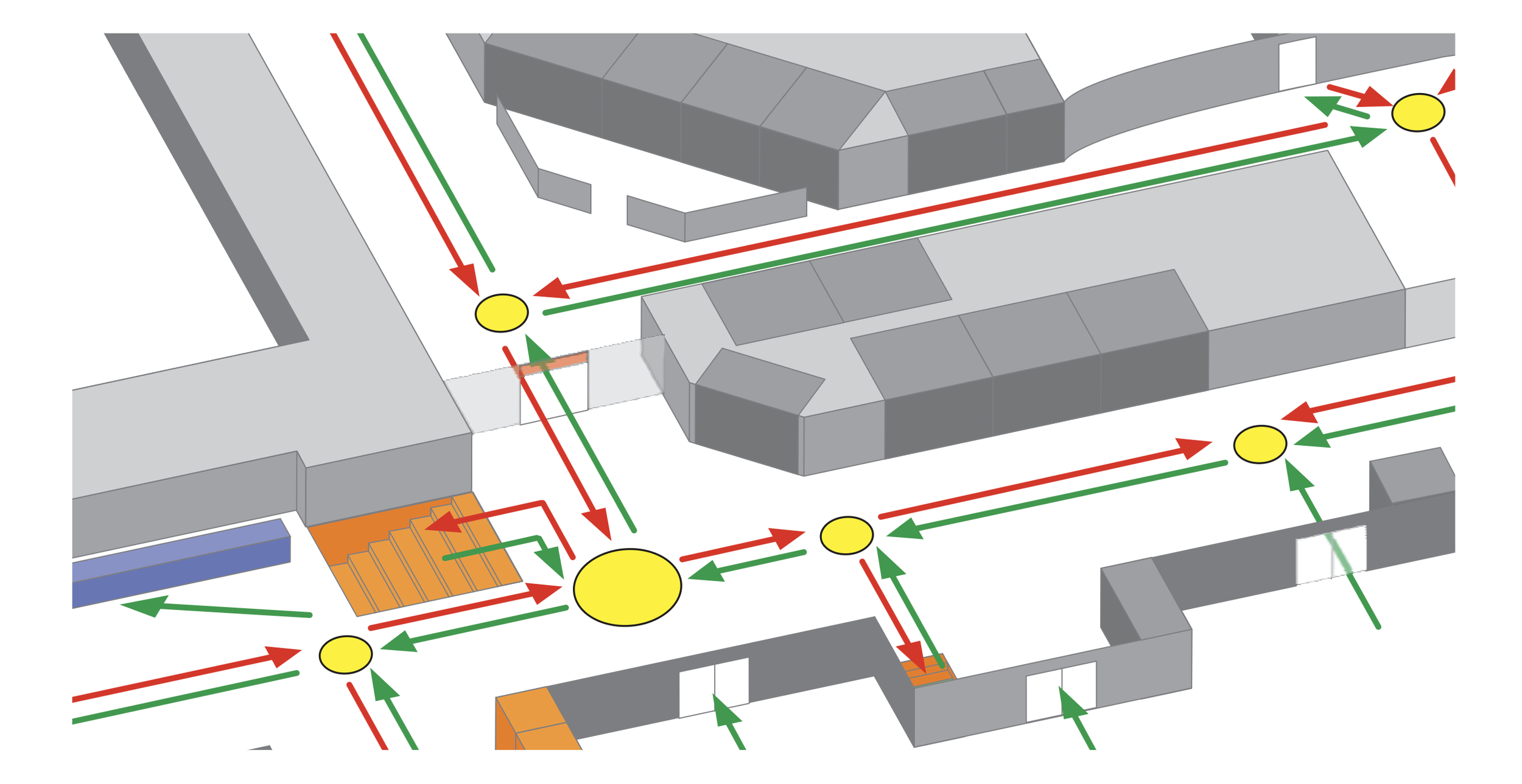
Reference diagram illustrating decision-point identification within a terminal circulation layout
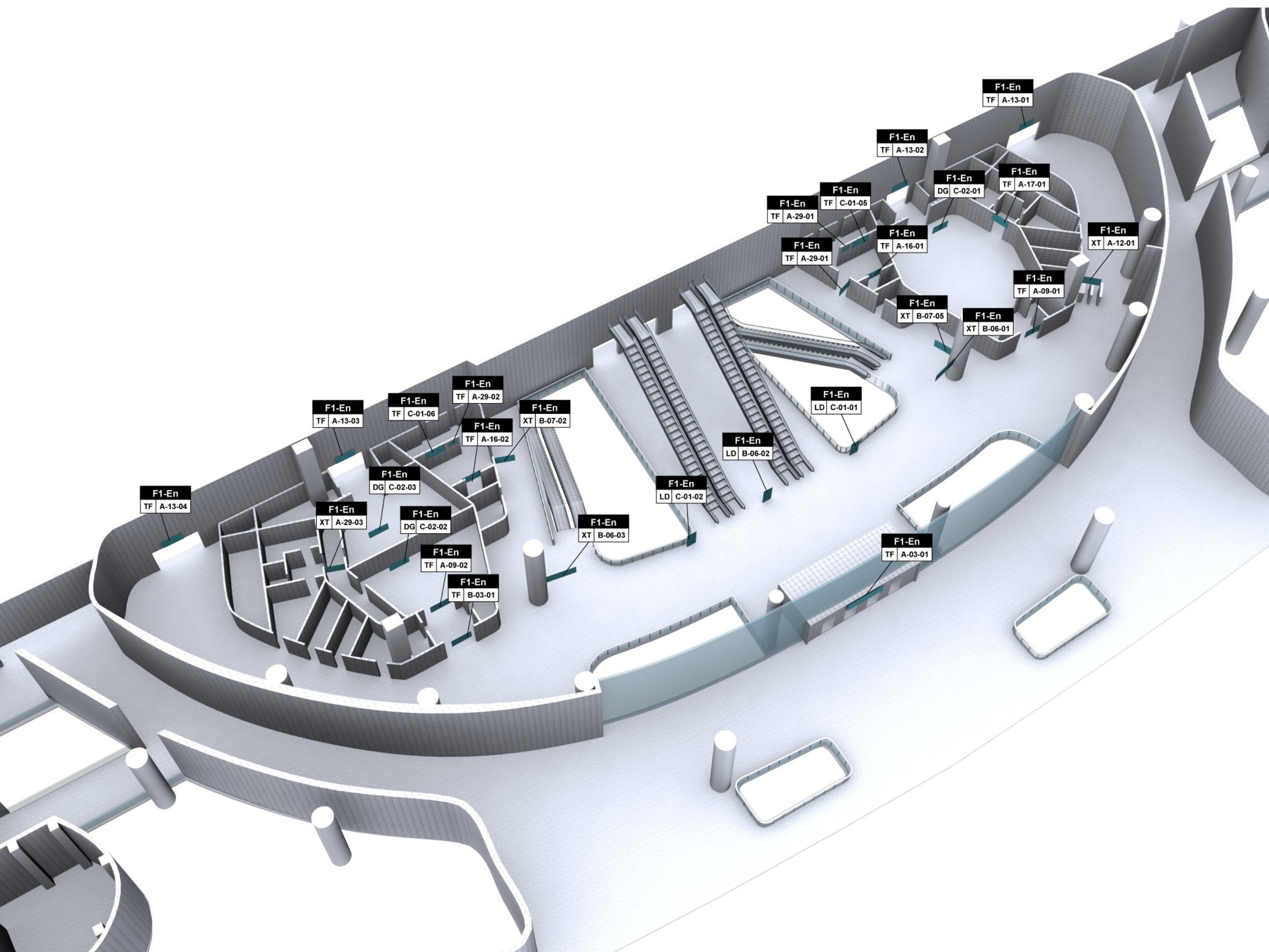
Decision points identified as anchors for signage placement and information hierarchy
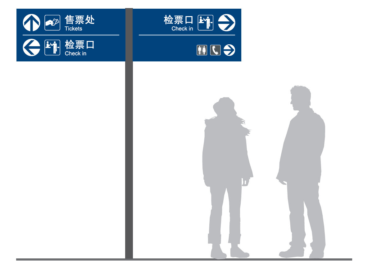
What - Information Content & Hierarchy
Once decision points were defined, we determined what information belonged at each point.
Information was structured into:
First-level: primary navigation (destinations, exits, platforms)
Second-level: directional clarification
Third-level: confirmation and reassurance
This hierarchy enabled:
fast decision-making under pressure
reduced cognitive load
consistency across the station
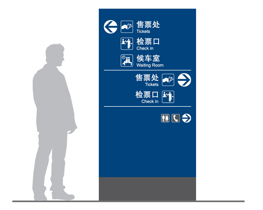
Information hierarchy defining first-, second-, and third-level content at each decision point
How - legibility, Form, and physical expression
Legibility Testing
Existing international standards did not adequately address:
Chinese character complexity
extreme viewing distances
dense passenger flow
I led original field research at Beijing South Station to establish minimum readable dimensions under real conditions.
Key Findings (25m viewing distance)
Chinese characters ≥ 10 cm
English letters ≥ 7 cm
Numbers ≥ 7 cm
Graphic symbols ≥ 15 cm
We also tested:
sign height and angle
lighting conditions
degraded visibility environments
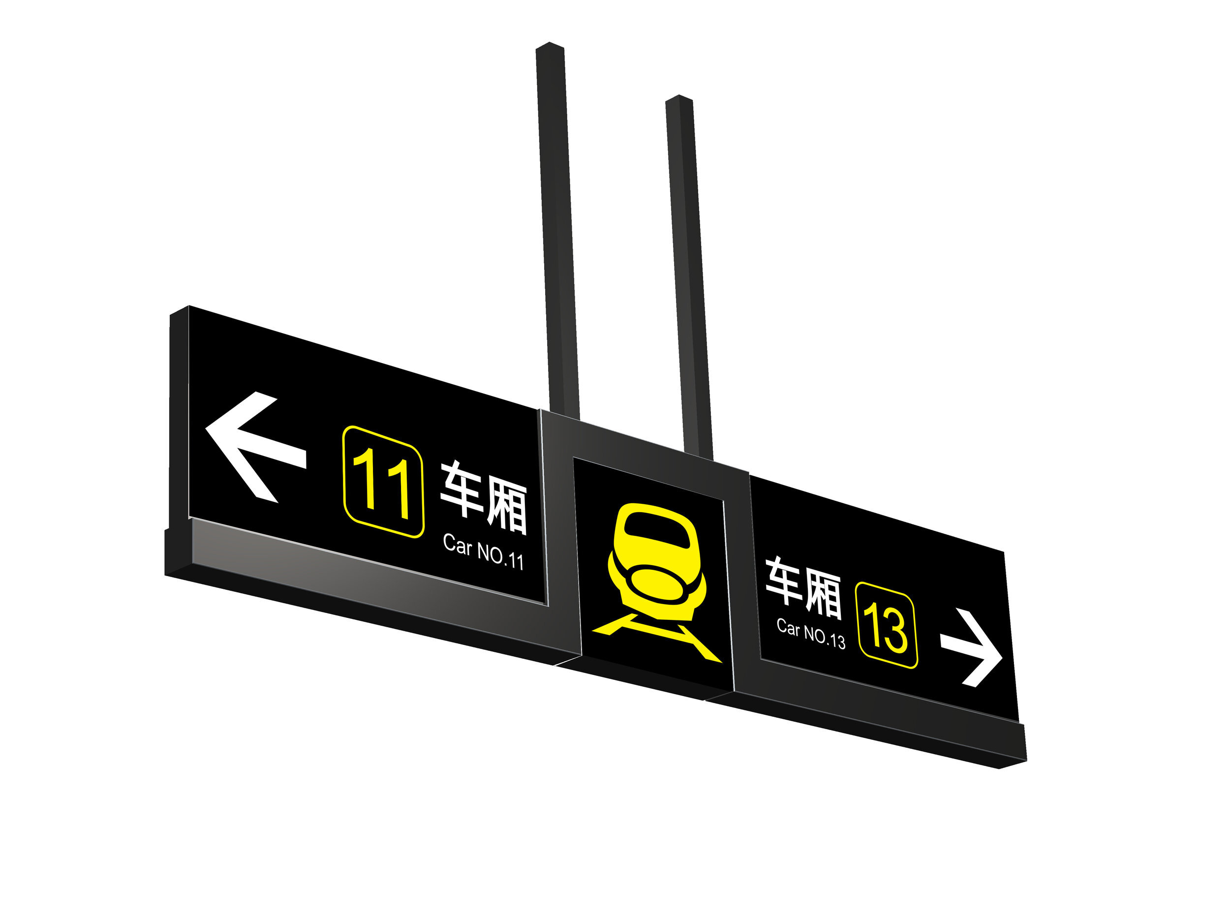
Graphic Design Collaboration
The information design team supported the graphic design process by:
providing data-backed size standards
advising on typography, spacing, contrast, and lighting
ensuring semantic clarity of symbols and arrows

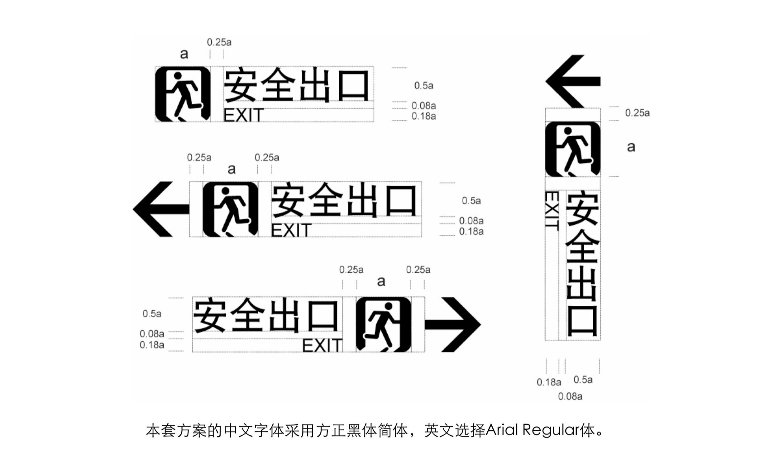
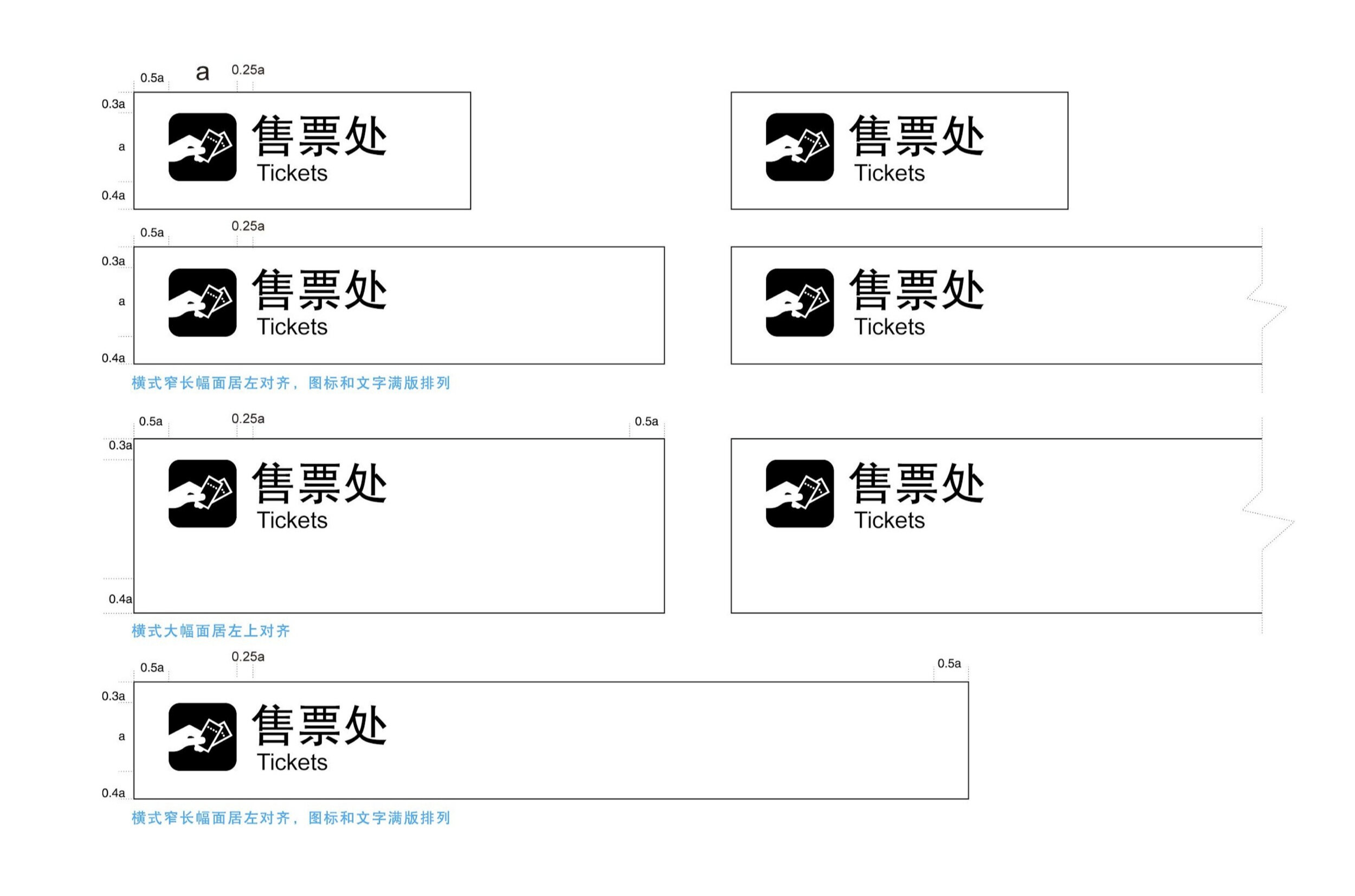


Graphic system implementation informed by information hierarchy and legibility standards
Signage Scale & Architectural Integration
The setting of signage and the expression of information are inherently tied to architectural scale—including ceiling height, viewing distance, and the physical size of the signage.
Beyond information clarity, the signage system needed to visually integrate with the station’s spatial environment to ensure consistency across different zones.
Final signage specifications were determined only after aligning:
plate size
installation height
spatial proportions
and architectural context
to maintain visual coherence throughout the station.
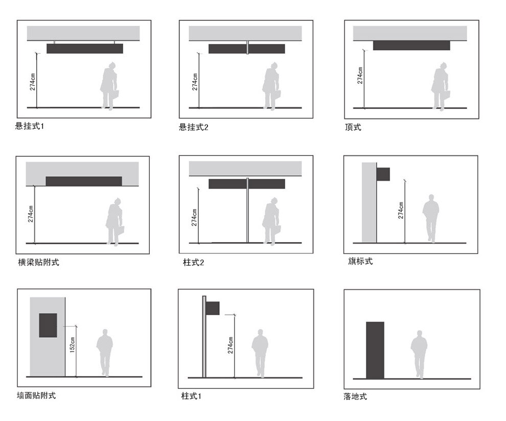

Integrating signage scale, installation height, and architectural proportions to ensure environmental consistency
Industry Design Collaboration
During industrial design exploration:
tested visibility under varied lighting conditions
validated legibility ratios in poor environments
ensured consistency between structure, scale, and information


Industrial design solutions integrated with information standards and spatial constraints
Final System & Legacy
The final signage system integrated:
spatial logic
decision-point-based information hierarchy
research-driven legibility standards
coordinated graphic and industrial form
The project established a repeatable, scalable model for large transportation hubs and continues to influence China’s railway infrastructure today.

A national signage system originating at Beijing South Station